TLDR;
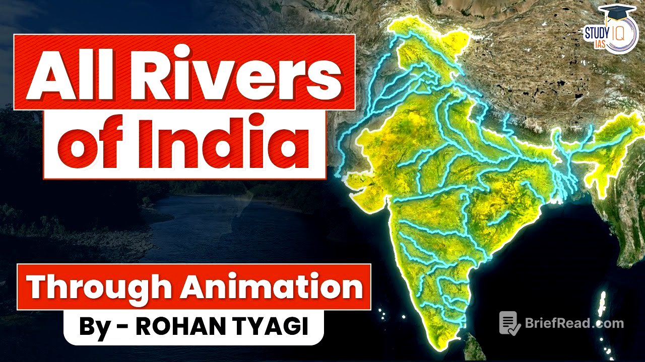
This video provides a detailed overview of the drainage system of India, covering the major rivers and their tributaries, categorized by Himalayan and Peninsular river systems. It explains the origin, course, and significance of rivers like the Indus, Ganga, Brahmaputra, Narmada, and Kaveri, along with their key tributaries and associated dams, disputes, and geographical features.
- Covers both Himalayan and Peninsular river systems.
- Explains the origin, course, and significance of major rivers.
- Discusses key tributaries, dams, disputes, and geographical features.
Introduction to Indian Rivers [0:15]
A river is a natural water stream flowing on the surface, typically sourced from a lake, glacier, waterfall, or rainwater, eventually draining into another river, lake, or ocean. Tributaries are smaller rivers that join a major river, while distributaries are branches that split from a river. The drainage basin, or river basin, encompasses the area from the river's source to its sink, including all tributaries and distributaries. India has 12 major basins (over 20,000 sq km), 46 medium basins (2,000 to 20,000 sq km), and numerous minor river basins (less than 2,000 sq km). Rivers can be classified by source (Himalayan, Peninsular), sink (Arabian Sea, Bay of Bengal), or water flow (Perennial, Non-Perennial). Perennial rivers have year-round flow, while non-perennial rivers depend on rainfall.
Indus River System [2:35]
The Indus River originates from Mansarovar Lake in the Kailash Range, Tibet, and flows 3,120 km to the Arabian Sea. Known as Sangi Sangpo in Tibet, it receives the Gar Sampo tributary. Entering India at Dam Chop, it passes through Le, Ladakh, where it merges with the Zanskar River. The Ninu Basco Hydro Electric Power Plant (Nimu Dam) is a run-of-the-river type dam constructed on Indus near Alaj. Crossing the Line of Control, it enters Gilgit Baltistan, merging with the Shyok River from Siachen Glacier, forming a boundary between the Karakoram, Ladakh, and Janska Ranges. The Tarbela Dam is constructed on this river just before it enters the Punjab Plains of Pakistan. The Indus receives waters from the Jhelum, Chenab, Ravi, Beas, and Sutlej at Mithan Kot, with the combined waters known as Panch Nat.
Tributaries of the Indus in Punjab [4:42]
The Jhelum River originates from Veri Nang at the base of the Pir Panjal Ranges in Southeast Kashmir, flowing through the Kashmir Valley and receiving waters from the Lider and Vaish Rivers. It passes through Srinagar, connected to Dal Lake via a canal, and meanders in the plain area of the Kashmir Valley. The river flows into Wular Lake, India's largest freshwater lake, and cuts through the Pir Panjal Ranges from Baramulla to Uri, entering Pakistan Occupied Kashmir and receiving the Neelam River in Muzaffarabad. The Kishan Ganga Hydro Electric Power Station is being developed on the Neelam River by India. The Mangla Dam is constructed on this river near Mirpur City. Historically, the Battle of Hydaspes was fought on its banks between King Porus and Alexander the Great.
Chenab River [6:13]
The Chenab River originates from the Lahaul region of Himachal Pradesh, formed by the Chandra and Bhaga streams meeting after Taandi. Known as Chandra Bhaga or Chenab, it is called Askani in Sanskrit. Flowing northwest, it enters Jammu and Kashmir, where the Ratle Hydro Electric Run of the River Dam is being constructed. The Baglihar Dam and Salal Dam are also located on this river. Near Reasi, India's largest lithium reserves have been recently discovered. The river enters Pakistan near Akhnoor, receiving the water of Jhelum in Jahang.
Ravi River [7:51]
The Ravi River originates from 12 Bengal in Himachal Pradesh, flowing northwest to Chamba Town, where the Chamera Dam is constructed. It demarcates the border of Himachal and Jammu and Kashmir, reaching the tri-point of Jammu and Kashmir, Himachal Pradesh, and Punjab. The Ranjit Sagar Dam is located on this border. Near Madhupur in Punjab, the river demarcates the India-Pakistan border for 80 km, near the Kartarpur Sahib Corridor, connecting Kartarpur Sahib and Dera Baba Nanak Gurudwara. The Harappa town of the Indus Valley Civilization is located on the Ravi River, known as Basni in Vedic texts.
Beas and Sutlej Rivers [8:55]
The Beas River originates from Beas Kund near Rohtang in Himachal Pradesh, flowing through Kangra District via Manali, Kullu, and Mandi District, where the Pong Dam (Maharana Pratap Sagar Dam) is constructed. This reservoir is a Ramsar Wetland site. The river enters Punjab and merges with Sutlej at Harike. The Beas River is known as Arij Ka or Pasha in Sanskrit. The Sutlej River originates in Tibet near Mansarovar Lake at Raksha Sthal Lake, called Lang Quan Zangbo in Tibet. It enters India from Shipkila in Kinnaur, Himachal, flowing east to Chhaba, where a small dam provides drinking water to Shimla. The Bhakra Nangal Dam (Govind Sagar Dam) is constructed on this river near Bhakra. From Nangal, the river enters Punjab, passing through Rupnagar to Ludhiana and reaching Harike, where Sutlej meets Beas.
Indus Water Treaty [10:25]
The Harike Patan Bird Sanctuary in Harike is a Ramsar site, hosting Indus River Dolphins. The Indira Gandhi Canal, drawn from Harike, irrigates Ganganagar and Bikaner. After Harike, the Sutlej River enters Pakistan near Kasur and joins Chenab at Uch Sharif, becoming Panch Nat. The confluence of Panj Nar with Indus occurs near Mithan Kot, after which Indus falls into the Arabian Sea through a delta east of Karachi. A distributor of the Indus once flowed into the Arabian Sea through the Rann of Kutch, but an 1819 earthquake elevated the land, creating Allah Band, diverting the distributor to Pakistan. The Indus Water Treaty, brokered by the World Bank in 1960, divides the waters of the Indus and its tributaries between India and Pakistan, allocating the waters of the western rivers (Indus, Jhelum, Chenab) to Pakistan and the eastern rivers (Ravi, Beas, Sutlej) to India.
Ganga River System and Panch Prayag [13:57]
The Ganga River, 2,510 km long, originates from the Gangotri glacier as Bhagirathi. After its confluence with Alaknanda at Devprayag, it is called Ganga. Before Devprayag, Alaknanda and its tributaries create Panch Prayag. The Alaknanda River originates from the Satapath glacier in Uttarakhand, merging with Bhauli Ganga at Vishnu Prayag near Joshimath. Alaknanda merges with Nandakini at Nand Prayag, Pandar River at Karna Prayag, and Mandakini River at Rudra Prayag. Finally, Alaknanda merges with Bhagirathi at Dev Prayag, forming the Ganga.
Course of the Ganga River [15:17]
The Ganga reaches Rishikesh from Dev Prayag and flows through Rajaji National Park and Tiger Reserve to Haridwar, entering Uttar Pradesh from Bijnor. In Uttar Pradesh, Ramganga falls into Ganga in Hardoi, and Yamuna joins in Prayag. After Gomti, Ganga enters Bihar, receiving water from Son River in Rewal Ganj and Gandak River. Ganga meets Kosi River at Kursela, flows on the Bihar-Jharkhand border, and enters West Bengal. Mahananda River falls into Ganga here. In Fara, water is diverted to Hooghly River through a canal. After entering Bangladesh, Ganga is called Padma, where Brahmaputra and Meghna rivers fall into Padma, creating the Sundarbans delta. Ajay and Damodar rivers fall into Hooghly River.
Yamuna River and its Tributaries [16:48]
The Yamuna River, the longest and second-largest tributary of Ganga, originates from Yamunotri Glacier near Bandar Poonch Ridge in Uttarakhand. Its largest tributary, Tonus, joins it at Kalsi in Dehradun. The river creates borders between Uttarakhand and Himachal Pradesh, and UP, Haryana, and Himachal. Yamuna defines the border of Haryana and UP until Delhi, entering Delhi from Wazirabad. Passing through Mathura, Agra, and Bateshwar, the river reaches Chhapra, where the Yamuna and Chambal meet, after which Yamuna meets Ganga in Prayag. Chambal, Sindh, and Betwa are major tributaries of Yamuna, originating from the northern slopes of Vindhyas.
Chambal, Betwa and Ken Rivers [18:15]
The Chambal River originates near Mah Town in Madhya Pradesh, flowing north and northeast, defining borders between Rajasthan and Madhya Pradesh, and Uttar Pradesh and Madhya Pradesh, before falling into the Yamuna River near Jalao in UP. Cities like Kota and Rawat Hata are located on this river. Shipra, Parvati, and Kali Sindh are major tributaries of Chambal. The Banas River, from the Aravallis of Rajasthan, is another major tributary. Gandhi Sagar, Indira Sagar, and Jawahar Sagar Dams are major dams on this river, which is also home to the critically endangered hadiyal. The Betwa River originates in Raisen, Madhya Pradesh, flowing north to Sanchi and the Mata Tila Dam on the UP-MP border, before joining the Yamuna near Hamirpur. The Ken River starts from the Kaimur range of Vindhyas, reaching Panna Tiger Reserve and entering Uttar Pradesh from Banda, falling into Yamuna near Chilla.
Son and Damodar Rivers [20:08]
The Son River originates in Amarkantak in the Satpura Hills of Chhattisgarh, close to the origin of the Narmada River. It enters Shahdol in Madhya Pradesh, taking a sharp east turn, where the Bansagar dam has been built. The river enters Uttar Pradesh from Son Badra district, merging with the Rihan River, where Govind Ballabh Pant Sagar Dam is located. Flowing parallel to the Kaimur Hills, it reaches the tri-point of UP, Bihar, and Jharkhand, where the North Koel River falls into it. The river divides Bhojpuri and Maghi speaking areas in Bihar and falls into the Ganges near Patna. The Damodar River originates from Chulha Pani Lateh in Jharkhand, falling into Hooghly in West Bengal. Barakar, Konar, and Jamunia are major tributaries. Once called the Sorrow of Bengal, the Damodar Valley Corporation has constructed Panchet Dam, Mython Dam, Tilaiya Dam, and Kunar Dam on this river, making it a boon for the region.
Ghagra, Sharda and Gandak Rivers [22:04]
The Ghagra River originates from the Map Chha Ngo Glacier near Mansarovar Lake in Tibet, called Map Chha Sampo. After entering Nepal, it is called Karnali River, dividing into Gerua and Koriala branches. After their confluence, it is called Ghagra in India. After the confluence of Ghagra and Sharda River, it is called Sarai in the Awadh region. The Rapti River is another major tributary near Chhapra in Bihar. The Sharda River, also known as Kali or Mahakali, has a disputed origin between India and Nepal. It defines the border between Uttarakhand and Nepal, entering the plains near Tanakpur town, where the Sharda reservoir is located. The Gandak River, also known as Gandaki in Nepal, originates from the Nu Bhai Himalayas of the Mustang region on the border of Nepal and Tibet, called Kali Gandhak. It creates the deep Kali Gandaki Gorge and enters India from Maharajganj in UP, called Gandhak or Narayani.
Koshi and Mahananda Rivers [24:56]
The Koshi River, a major tributary of Ganga, is also known as the Sorrow of Bihar. It is formed by the confluence of seven major tributaries, including Arun River, Tamur River, and Sun Koshi River. Sun Koshi River starts from the Sang Jangbo glacier in Tibet, joined by Doodh Koshi, Tama Koshi, Boote Koshi, and Indravati. The river enters India from Dubi Hai in Bihar and falls into Gangaji near Bhagalpur. Due to its unstable course and high sediment load, it causes floods in North Bihar. The Mahananda River starts from Pagla Jhoda Falls in West Bengal, passing through Siliguri town and the Chicken's Neck of India. It defines the border of India and Bangladesh for a short distance and enters Kishanganj in Bihar, merging with the Machhi River. The combined stream is called Full Har River, entering West Bengal from Malda and finally merging with Ganga ji in Bangladesh.
Brahmaputra River System [27:14]
The Brahmaputra River originates from the Chhe Ma Yung Do Angsi Glacier east of Mansarovar Lake in Tibet, called Yarlang Sampo. Taking a sharp turn from the Nam Chha Barwa Peak, it enters Arunachal Pradesh from Galing, called Siang or Diha. From Pasi Ghat, it enters the plains, where Lohit and Dibang rivers join it, known as Brahmaputra in Assam. The Hing river from Arunachal Nagaland falls into it, and Brahmaputra merges with Suban Siri, its largest tributary in India. At the confluence of Subansiri and Brahmaputra, the world's largest river island, Majauli, has been created. The Kameng, Bekhi, Manas, and Popli rivers fall into Brahmaputra. After Dhubi of Assam, Brahmaputra enters Bangladesh, merging with Teesta river from Sikkim, known as Jamuna. After the confluence of Jamuna and Padma, it becomes the second-largest river of the world, falling into the Bay of Bengal through the Sundarban delta.
Meghna and Teesta Rivers [29:02]
In Bangladesh, the Brahmaputra gets divided into two branches: one merges with Ganga (Padma), and the second is Meghna. The Meghna River originates from the Liai Khulan village on the border of Manipur, called Barak. Near the Manipur Mizoram border, it takes a sharp turn and flows westward, reaching Bangladesh via Silchar in Assam. In Bangladesh, the river gets divided into Surma and Kushiyara branches, which meet again and are called Meghna, falling into a branch of Brahmaputra Padma and creating the Ganga Brahmaputra Delta. The river is navigable in India and has been declared a National Waterway between Lakhipur and Bhanga. The Teesta River starts from Khang Glacier and Zemu Glacier in North Sikkim, formed from the meltwater of these glaciers. It crosses the High Himalayas and reaches Rangpo, where the Rangpo River joins the Teesta, creating the border between Teesta and West Bengal. The river enters the plains from Sivok in West Bengal, and the Coronation Bridge and Sivo Rail Bridge are located here. The river enters Bangladesh after Lapaiguri and falls into the Brahmaputra.
Luni River [32:19]
The Luni River originates from the Aravalli Hills near Ajmer, called Sagarmati. Ahead of Govindgarh, it merges with the Saraswati River from Pushkar Lake, called Luni or Lavnavati. It is one of the main rivers west of Aravalli, used for extensive irrigation. The river carries fresh water until Balo in Barmer, but saline water mixes in from Balra, becoming salty, called Lavnavati or Luni. From Barmer, the river enters Patan in Gujarat and evaporates in the Rann of Kutch. The drainage system is closed, called Effi Mer Drainage. The Luni river is famous for flash floods due to flowing in a shallow bed.
Westward Flowing Rivers: Sabarmati, Mahi, Narmada, and Tapi [33:28]
The Sabarmati River originates from Debar Lake in the Aravalli Hills of Udaipur District in Rajasthan, passing through Gandhinagar and Ahmedabad, reaching the Wolf of Khant in the Arabian Sea. The Dharoi Dam is a major dam on this river. The Mahi River originates from Manda Village in Dhar District in the northern slopes of Vindhyas in Madhya Pradesh, entering Rajasthan and Gujarat, falling into the Arabian Sea near Vadodara. It cuts the Tropic of Cancer twice, and the Bansawala Dam in Rajasthan is a major dam on this river. The Narmada River originates in Amarkantak of Satpura in Madhya Pradesh, the longest west-flowing river in complete India. Flowing in the rift valley between Vindhyas and Satpura, it creates Dhuadhar waterfall near Jabalpur, reaching Omkareshwar and the Indirasagar Dam. The Sardar Sarovar Dam and Statue of Unity are located on this river, flowing into the Gulf of Khant. The Tapi River originates from Multai in the Satpura Mountains of Madhya Pradesh, creating Ras Dhu waterfall. Flowing through Madhya Pradesh, Maharashtra, and Gujarat, a dam has been built on this river in Gujarat, falling into the Arabian Sea through Surat.
Rivers of Goa and Kerala [36:24]
Goa has two important rivers, Mando and Zuari, both originating from the Western Ghats. Kerala has 44 major rivers, with three called the lifeline of Kerala: the Bharatpurja River, originating from the Anamalai Hills of the Western Ghats, falling into Lake Dive; the Periya River, originating from Ukkam Patti Mala of the Western Ghats, flowing through the plains of Kerala; and the Pamba River, originating from Pala Chu Mala of the Western Ghats, flowing through the coastal plains of Kerala and falling into Benad Lake, near the Sabarimala Temple.
East Coast Rivers: Sub Rekha, Betani, Brahmani, Mahanadi, Rushfalia, and Vans Dhara [37:41]
The Sub Rekha River starts from Piska Jharkhand, entering West Bengal and falling into the Bay of Bengal through Orissa. The Betani River originates from Gupt Ganga Hills of Eastern Ghats, falling into the Bay of Bengal near Bhitra Kanika. The Brahmani River is formed from the confluence of Shankh and South Koel River from Jharkhand, flowing through Orissa and falling into the Bay of Bengal near Bhitra Kanika. The Mahanadi River starts from Sihawa of Chhattisgarh, flowing through Orissa and falling into the Bay of Bengal through a large delta. The Daya River is a distributor of Mahanadi River, falling into Chilika Ghat. The Rushfalia River starts from Eastern Ghats and falls into the Bay of Bengal from Ganjam District. The Vans Dhara River starts from Kalahandi in Odisha, flowing majorly in Odisha, entering Andhra Pradesh, and falling into the Bay of Bengal in Kalinga Patam.
Godavari River System [39:15]
The Godavari River, also called Dakshin Ganga, originates in Trimbakeshwar near Nashik in Shia Dari of Western Ghats. Forming waterfalls, it reaches Paithan, where the Chayakwadi Dam is located. Godavari merges with Purna River and enters Telangana, merging with Manjil River from Balaghat Ranges. The Sriram Sagar Dam is located on this river in Telangana. The river reaches the tri-point of Telangana, Maharashtra, and Chhattisgarh, where Pern Hita River joins it, formed by the confluence of Vai Ganga and Wardha from Sakpura. The Kaleshwaram Dam is under construction at this tri-point. Godavari merges with Indravati River from Orissa and Chhattisgarh, entering Andhra and the Polavaram Dam is constructed on it, falling into the Bay of Bengal through the delta.
Krishna River System [41:57]
The Krishna River originates from Mahabaleshwar in the Western Ghats in Satara district of Maharashtra, flowing east. The Dhoom Dam is created on the Krishna River. The Al Mati Dam is constructed on this river in Karnataka, after which Krishna's confluence takes place with Mal Prabha. The Basava Sagar Dam is constructed on this river. Krishna reaches the Karnataka Telangana border, merging with its longest tributary Bhima from Bhim Shankar of Maharashtra. Krishna merges with Tunga Bhadra, where Shri Salim Dam is constructed on the Telangana Andhra Pradesh border. The Naga Arjun Sagar Dam is constructed on this river, entering Andhra Pradesh and Vijayawada.
Tunga Bhadra River and Rivers Between Krishna and Cauvery [43:13]
The Tunga Bhadra River originates at the confluence of Tunga and Bhadra rivers in Kodali of Shimoga district. The Tunga river starts from Ganga Mool Hills of Western Ghats, and the Bhadra river originates from Ganga Mool of Western Ghats. The combined stream is called Tunga Bhatra, reaching Hampi, where the Veeru Paksha Temple overlooks this river. The river reaches the Karnataka Telangana border, merging with Krishna river on the Telangana Andhra border, where Shri Salim Dam has been constructed. The three rivers between Krishna and Cauvery originate from Nandi Hills: Pennar River, Palla River, and Paniyar River. The Pennar River flows north from Nandi Hills, entering Andhra and taking an eastward turn from Jarat La Rampurum, where the MPR Dam is constructed. The Palla River flows east, entering Andhra Pradesh and Tamil Nadu, falling in the Bay of Bengal. The Paniyar River enters Tamil Nadu directly from Karnataka, entering the Bay of Bengal near the border of Tamil Nadu and Puducherry.
Cauvery River and Conclusion [45:34]
The Cauvery River receives water from both South West and North East monsoons, making it perennial. It starts from a lake in the Brahmagiri range of Western Ghats in Karnataka, called Lake Kaveri. The river moves east, forming the Serang Patnam and Shiva Samudram islands near Mysore, with Shiva Samudram falls located on this river. After entering Tamil Nadu, the direction becomes South Easterly, forming the Sri Rangam island. Krishna Raja Sagar Dam and Matu R Dam are the major dams on this river. Hemavathi, Arkavati, Kabani Bhavani, and Amaravati are the major tributaries. There is a dispute between Tamil Nadu, Karnataka, and Pondicherry over the water distribution of the Cauvery River. The Vagai River originates from Barusanadu Hill of Western Ghats, falling into Park Bay near Ramanathapuram.