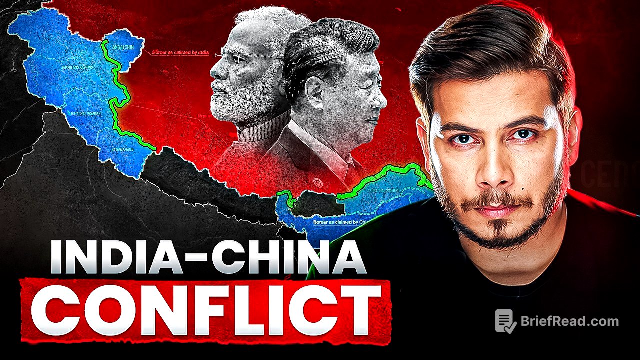
TLDR;
This video provides a detailed historical overview of the India-China border dispute, starting from ancient empires to the present day. It covers key treaties, border lines proposed by the British, and the events leading up to the 1962 war and subsequent conflicts. The video also addresses the current Line of Actual Control (LAC), China's "salami-slicing" strategy, and recent infrastructure developments.
- Historical context from ancient empires to British India.
- Key treaties and border proposals.
- Events leading to the 1962 war and the establishment of the LAC.
- China's "salami-slicing" strategy and infrastructure development.
- Recent conflicts and the current state of the border dispute.
Ancient Empires and the Formation of Ladakh [1:13]
In 625 AD, the Tibetan Empire existed alongside various Indian empires, encompassing areas including present-day Ladakh and Arunachal Pradesh. After King Langdarma's death in 842 AD, his relatives fought for control, leading Nyimagon, a great-grandson, to secede and establish the Ngari Kingdom in the western part of the Tibetan Empire. This area is significant because it covers much of the currently disputed western India-China border. Later, Nyimagon's son, Lhachen, expanded the kingdom, renaming it the Maryul Kingdom, which by 1460, became known as the Ladakh Kingdom, ruled by the Namgyal dynasty, which increased its influence in the region.
Treaty of Tingmosgang and Chinese Influence in Tibet [3:09]
As the Ladakh Kingdom grew, the Tibetan Empire, viewing it as a threat, attacked Ladakh. Ladakh sought assistance from the Mughal Empire, leading to the Treaty of Tingmosgang in 1684. This treaty established a border between Tibet and Ladakh, marking the first formal border agreement in the region. In 1720, China's Qing Empire indirectly took control of Tibet by removing the ruler of the Tibetan Empire and replacing him with the 7th Dalai Lama, Kelzang, placing Tibet under Chinese protection.
Dogra-Sikh Empire and the Treaty of Chusul [5:58]
In 1819, the Sikh Empire attacked and controlled the Dogra Empire (present-day Jammu & Kashmir), which then extended its control over Ladakh. By 1842, the Dogra-Sikh Empire expanded Ladakh's territory, leading to the Treaty of Chusul on September 17, 1842, between Tibet and the Dogra-Sikh Empire, with China as a signatory. This treaty demarcated the Ladakh-Tibet border, reaffirming the "Old Established frontiers" from the Treaty of Tingmosgang. Crucially, China's signature on this treaty indicated its acceptance of Aksai Chin as part of Ladakh, strengthening India's claim over the region today.
British Influence and Border Proposals [9:08]
In 1845, with the British ruling India and fearing Russian expansion, securing the northern boundary became crucial. The British attacked the Sikh Empire, gaining influence in the area. They commissioned the Great Trigonometrical Survey of India in 1855 to define a proper border, leading to the Johnson Line, which India still uses in its maps. In 1890, the British secured the Sikkim border with China. Unhappy with the Johnson Line, the British proposed the Macartney-MacDonald Line in 1899, ceding most of Aksai Chin to China, which China never formally accepted.
Shimla Convention and Tibet's Status [13:54]
In 1914, the British convened the Shimla Convention to create a buffer zone between British India and Tibet, dividing Tibet into Inner and Outer Tibet. Inner Tibet was given to China, while Outer Tibet was placed under the Dalai Lama. The MacMohan Line was introduced to define Arunachal Pradesh's border with Tibet. China, however, refused to sign the agreement, claiming all of Tibet. Despite this, the British continued to show Aksai Chin under British India in official documents and maps.
Post-Independence and China's Expansion [16:46]
After India's independence in 1947, Nehru accepted the British-defined borders. In 1949, Mao Zedong's Communist party established the People's Republic of China (PRC) and invalidated previous agreements, claiming all of Tibet. In 1950, Mao attacked Outer Tibet, leading the Dalai Lama to seek refuge in India. Despite this aggression, India supplied rice to China. The US offered India a permanent seat in the UN Security Council, but India suggested it be given to the PRC.
Highway G219 and the 1962 War [19:16]
China began constructing Highway G219 in Aksai Chin without informing India. When India discovered this, it released an official map showing Aksai Chin as part of India and deployed troops. China then sent 16 land points defining its claimed territory, around which the current LAC is based. The 1962 war resulted in China deeply penetrating Aksai Chin and Arunachal Pradesh, intending to exchange Arunachal Pradesh for Aksai Chin. On November 21, 1962, China stopped the war, retreating from the MacMohan Line in Arunachal Pradesh but maintaining control over Aksai Chin.
The Line of Actual Control (LAC) [22:45]
The LAC is a complex, undefined area with varying claims from India and China. India considers the Johnson Line as the border, while the LAC represents the area under actual control. The region between the LACs claimed by both countries serves as a buffer zone with patrolling but no permanent military posts. The Galwan war occurred within this buffer zone. In 1963, Pakistan gifted the Shaksgam valley to China, further complicating the border situation.
Nathu La Clash and Peaceful Agreements [23:53]
In 1967, as India began fencing the Sikkim border, Chinese soldiers attacked Indian soldiers at Nathu La, resulting in significant casualties. However, Indian forces retaliated, inflicting heavy losses on the Chinese. From 1993 to 1996, India and China focused on peaceful agreements, recognizing the LAC in the middle and eastern sectors but maintaining differing perceptions in the western sector. Agreements included refraining from bombardment, firing, or gathering weapons along the LAC.
China's "Salami-Slicing" Strategy and Infrastructure Development [28:45]
After signing peaceful agreements, China began rapidly developing infrastructure near the LAC, while India's infrastructure development was slow due to economic constraints and internal opposition. China employed a "salami-slicing" strategy, gradually encroaching on small areas. By 2007, China had conducted 130 secret incursions. This strategy has resulted in India losing access to 26 patrolling points out of 65 in the Aksai Chin area. China also established villages near the LAC to monitor Indian activities and strengthen its position.
Recent Aggressions and the Galwan Valley Clash [34:10]
As India began developing infrastructure, particularly the Daulat Beg Oldi road, China showed aggression. In May 2020, Chinese soldiers blocked Indian patrols at Finger 4 of Pangong Tso Lake, leading to clashes. On June 15, 2020, a violent clash in the Galwan Valley resulted in the deaths of 20 Indian soldiers and approximately 40 Chinese soldiers. Satellite images revealed China's rapid construction of posts in the area. Reports indicate that China has gained control over approximately 1000 sq. km of Indian territory. Despite this, India is rapidly increasing its infrastructure near the LAC.
Current Situation and Future Prospects [39:22]
China is attempting to encircle India in the sea and supplying weapons to Pakistan. Experts believe a two-front war between India and China is likely. Both countries are currently preparing for this possibility.