TLDR;
This video provides a comprehensive overview of Bihar's general knowledge, covering its history, geography, climate, economy, and culture. It explores the origin of Bihar's name, its administrative divisions, geographical features, climate patterns, river systems, and biodiversity. The video also highlights the state's demographic profile, including population density, literacy rates, and linguistic diversity, along with its rich cultural heritage, including art forms like Madhubani painting and GI-tagged products.
- Origin and Evolution of Bihar
- Geographical and Climatic Diversity
- Cultural Heritage and Economic Aspects
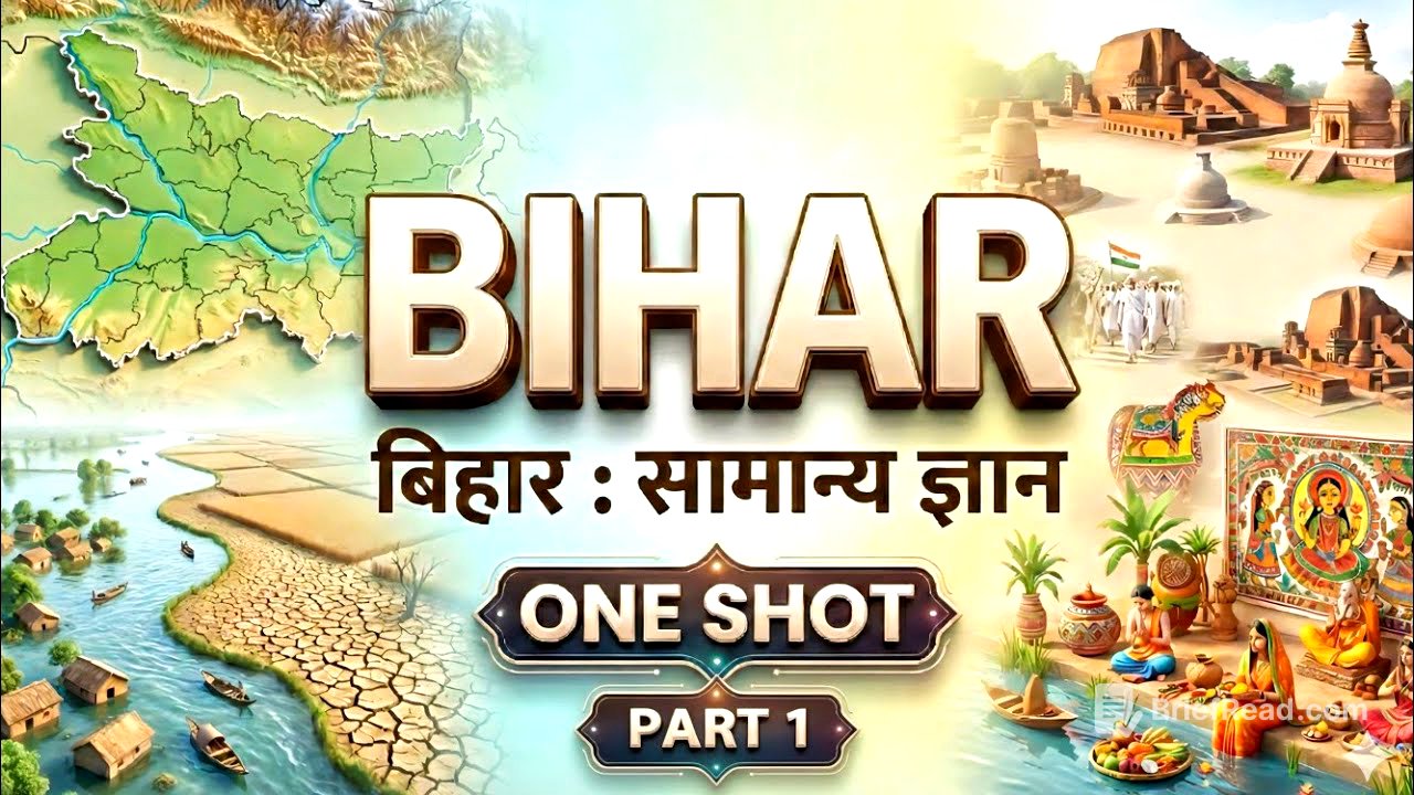
Bihar: An Introduction [0:00]
The name "Bihar" is derived from "Vihara," referring to the monasteries of Buddhist monks, highlighting the region's historical significance as a center of knowledge and spirituality. The state's current form began in 1912 when it was separated from the Bengal province, followed by the separation of Orissa in 1936, and the creation of Jharkhand in 2000. Bihar is located between 24°20'10" and 27°31'15" north latitude and 83°19'50" and 88°17'40" east longitude, covering an area of 94,163 square kilometers, making it the 13th largest state in India.
Administrative and Geographical Structure [0:20]
Bihar has a diverse administrative structure with 38 districts divided into nine divisions. The largest district is West Champaran, bordering Nepal, while the smallest is Sheohar. The northernmost district is West Champaran, the southernmost is Gaya, the westernmost is Kaimur, and the easternmost is Kishanganj. The state extends 345 km from north to south and 483 km from east to west.
Climate and Demographics [1:51]
Bihar has a monsoon-dependent climate with an average annual rainfall of 125 mm, varying from high rainfall in Kishanganj to lower amounts in Kaimur, Rohtas, Aurangabad, and Gaya. Gaya is the hottest location, while Kishanganj is the coldest due to high rainfall and humidity. According to the 2011 census, Bihar's population is approximately 104.1 million, with a population density of 1,106 people per square kilometer, the highest in India. Patna has the highest population, and Sheikhpura has the lowest. The sex ratio is 918 females per 1,000 males, and the literacy rate is 61.8%, the lowest in the country, with male literacy at 71.2% and female literacy at 51.5%.
Languages and State Symbols [3:59]
The official languages of Bihar are Hindi and Urdu, but regional languages like Maithili, Bhojpuri, Magahi, Angika, and Vajjika are widely spoken. Maithili is recognized in the Eighth Schedule of the Constitution. The state animal is the bull, the state bird is the sparrow, the state tree is the peepal, and the state flower is the marigold.
Rivers of Bihar [5:38]
The Ganga River divides Bihar into northern and southern parts, each with distinct river characteristics. Northern rivers like Kosi, Gandak, and Burhi Gandak originate in the Himalayas, carrying high volumes of water and silt, often causing floods. Kosi is known as the "Sorrow of Bihar" due to its unpredictable course changes. Southern rivers like Son, Punpun, and Falgu are plateau-based and primarily rain-fed, often drying up in the summer. The Falgu River flows beneath the sand in Gaya.
National Parks, Wildlife Sanctuaries, and Heritage Sites [7:04]
Bihar has one national park, Valmiki National Park in West Champaran, and its first Ramsar site is Kanwar Lake in Begusarai. Recently, Nagi and Nakti Bird Sanctuaries in Jamui have also been designated as Ramsar sites. The state boasts two UNESCO World Heritage Sites: the Mahabodhi Temple Complex in Bodh Gaya, recognized in 2002, and the Archaeological Site of Nalanda Mahavihara, included in 2016.
Art, GI Tags, and Cuisine [8:06]
Madhubani painting, also known as Mithila painting, is a renowned art form from the Madhubani and Darbhanga regions. Other notable arts include Tikuli art from Patna. Bihar has several GI-tagged products, including Shahi Litchi from Muzaffarpur, Jardalu Mango from Bhagalpur, Katarni Rice, Magahi Paan, Mithila Makhana, and Marcha Dhan from West Champaran. Handicrafts include Madhubani paintings, Sujani embroidery, Sikki grass products, and Bhagalpuri Silk. Popular dishes include Litti Chokha, Dahi Chura, Khichdi, Sattu Sharbat, Champaran Meat, Malpua, Thekua, and Tilkut.
District Overview and Bordering Regions [10:01]
Bihar is divided into 38 districts and nine divisions, with 101 subdivisions, 534 CD blocks, approximately 8,406 panchayats, and around 45,103 revenue villages. Some districts have headquarters with different names, such as Kaimur (Bhabua), Rohtas (Sasaram), Bhojpur (Ara), Saran (Chhapra), East Champaran (Motihari), West Champaran (Bettiah), and Vaishali (Hajipur). Patna, Tirhut, and Munger divisions have six districts each, Magadh has five, Purnia has four, and Saran, Darbhanga, and Kosi have three each. Bhagalpur is the smallest division with only two districts.
Geographical Boundaries and Physical Divisions [13:05]
Bihar is a landlocked state bordered by Nepal to the north, Jharkhand to the south, West Bengal to the east, and Uttar Pradesh to the west. Eight districts border Jharkhand (Rohtas, Aurangabad, Gaya, Nawada, Jamui, Banka, Bhagalpur, and Katihar) and Uttar Pradesh (Rohtas, Kaimur, Buxar, Bhojpur, Saran, Siwan, Gopalganj, and West Champaran). West Bengal shares borders with three districts (Katihar, Purnia, and Kishanganj), while Nepal borders seven districts (West Champaran, East Champaran, Sitamarhi, Madhubani, Supaul, Araria, and Kishanganj). The state can be divided into three main physical regions: the Himalayan Shivalik range in the north, the Gangetic plain in the middle, and the plateau region in the south.
Physical Features: Mountains, Plains, and Plateaus [15:35]
The Shivalik range in West Champaran features the Ramnagar Doon, Someshwar Range (highest peak at 880 meters), and Doon Valley (Harha Valley). The Gangetic plain covers about 96.27% of Bihar's area, formed by the Ganga and its tributaries. The plain is divided into the northern and southern plains, with the northern plain characterized by rivers like Ghaghra, Gandak, and Kosi, prone to flooding. The southern plain, also known as the Magadh plain, is formed by rivers like Son and Punpun, with unique "Tal" areas that are fertile after monsoon floods recede. The southern plateau region, an extension of the Chota Nagpur Plateau, includes the Kaimur Plateau, Gaya hills, Rajgir hills, and the hills of Nawada, Kiul, and Banka.
Climate Classification and Seasonal Variations [26:47]
Bihar has a modified subtropical monsoon climate, influenced by the Himalayas and the Bay of Bengal. The eastern parts experience higher humidity and rainfall, while the western parts are drier. The climate is classified by Koppen as Cwg (Ganga plains) and Aw (tropical savanna in southern Bihar). Summers (March to mid-June) are hot, with Gaya being the hottest location. The monsoon season (mid-June to mid-October) brings about 85% of the state's rainfall. Winters (November to February) are pleasant, with January being the coldest month.
Soil Types in Bihar [34:18]
Bihar's soils are divided into three main types: Northern Bihar Plain, Southern Bihar Plain, and Southern Plateau. The Northern Bihar Plain consists of Piedmont Soil, Tarai Soil, Bangar Soil (old alluvial), and Khadar Soil (new alluvial). The Southern Bihar Plain includes Karail Kewal Soil, Tal Soil, Balthar Soil, and Kagar Soil. The Southern Plateau region features Red and Yellow Soil and Red Sandy Soil.
Mineral Resources of Bihar [40:56]
Bihar's mineral resources are primarily located in the southern part of the state. Key minerals include Pyrite (monopoly in India), Limestone, Mica, China Clay, Quartzite, Feldspar, Quartz, Bauxite, Saltpeter, Slate, Galena, Sandstone, Soapstone, and potential reserves of mineral oil, gas, gold, and uranium.
Waterfalls of Bihar [50:05]
Bihar has several waterfalls, mainly in the Kaimur, Rohtas, and Nawada districts. Key waterfalls include Kakolat Waterfall (Nawada), Durgawati Waterfall (Rohtas), Dhua Kund (Sasaram), Manjhar Kund (Sasaram), Telhar Kund (Kaimur), and Tutla Bhawani Waterfall (Rohtas).
Wildlife Sanctuaries and Ramsar Sites [57:18]
Bihar has one national park, Valmiki National Park, and 11 wildlife sanctuaries. Key sanctuaries include Kaimur Wildlife Sanctuary, Rajgir Wildlife Sanctuary, Vikramshila Gangetic Dolphin Wildlife Sanctuary, Bhimbandh Wildlife Sanctuary, and Gautam Buddha Wildlife Sanctuary. The state has three Ramsar sites: Kanwar Lake Bird Sanctuary, Nagi Dam Bird Sanctuary, and Nakti Dam Bird Sanctuary.
Major Crops of Bihar [1:04:04]
Agriculture is the primary occupation in Bihar, with about three-quarters of the population dependent on it. The state has three main crop seasons: Kharif (June-July sowing, October-November harvesting), Rabi, and Zaid. Rice is the dominant crop, covering about 45% of the cultivated land, with Rohtas, Aurangabad, and Kaimur being major producers due to irrigation facilities. Wheat is the second-largest crop, covering about 29% of the land. Maize is significant in Begusarai, known as the "Maize Home" of the state. Cash crops include sugarcane and tobacco. Makhana is a unique crop primarily grown in the Mithila region, with over 90% of India's production coming from Bihar.
Major Lakes of Bihar [1:10:58]
Most lakes in Bihar, especially in the northern part, are oxbow lakes formed by rivers changing course. Key lakes include Kanwar Lake (Begusarai), Kusheshwar Sthan Lake (Darbhanga), Anupam Lake (Kaimur), Goga Katora Lake (Nalanda), Gogabil Lake (Katihar), Matsyagandha Lake (Saharsa), Simri Bakhtiarpur Lake (Saharsa), and Muchalinda Lake (Gaya).
Irrigation Systems in Bihar [1:15:41]
Bihar's irrigation is heavily reliant on groundwater, with tube wells accounting for about 63.9% of irrigation, followed by canals at 30%. The total irrigated area is approximately 72.07 lakh hectares. Rohtas is the most irrigated district, while Sheohar is the least. Key irrigation projects include the Kosi Project, Gandak Project, and Son Project.
Tourism Industry in Bihar [1:21:56]
Bihar has significant tourism potential, attracting about 6 million tourists annually. The tourism industry contributes 5-6% to the state's economy. Tourism is categorized into pilgrimage, historical, sports, wildlife, and medical tourism. Key circuits include the Buddhist Circuit, Ramayana Circuit, Jain Circuit, Sikh Circuit, Sufi Circuit, Eco Circuit, and Gandhi Circuit.
Major Tribes in Bihar [1:30:41]
Scheduled Tribes (ST) constitute only 1.68% of Bihar's population, mainly concentrated in the southern districts. Key tribes include Gond, Khond, Pedia, Oraon, Santhal, Kharwar, Gorait, Chero, Kora, Korwa, and Munda.
Population of Bihar [1:35:39]
As of 2011, Bihar's population was approximately 104.1 million, about 8.6% of India's total population, making it the third most populous state. Only 11.29% of the population resides in urban areas. The population density is 1,106 people per square kilometer, the highest in India. The sex ratio is 918 females per 1,000 males, and the literacy rate is 61.8%.
Transportation and Communication Systems in Bihar [1:43:12]
The transport and communication sector contributes about 11% to Bihar's GSDP. The state has approximately 2.91 lakh kilometers of roads, ranking eighth in India. Bihar also has a significant railway network, with the East Central Railway headquartered in Hajipur. The state has two international airports (Patna and Gaya) and several domestic airports.
Major Thermal Power Projects in Bihar [1:52:44]
Key thermal power projects in Bihar include the Barauni Thermal Power Station, Muzaffarpur Thermal Power Station (George Fernandes Thermal Power Station), Nabinagar Thermal Power Station, Aurangabad Thermal Power Project, and Kahalgaon Thermal Power Project.
Major Rivers in Bihar [1:57:44]
Bihar's rivers are divided into those originating from the Himalayas (perennial) and those from the peninsular plateau (seasonal). Key rivers include the Ganga, Ghaghra, Gandak, Burhi Gandak, Bagmati, Kosi, Mahananda, Karmanasa, Son, Punpun, and Falgu.
Afghan Rule and Medieval Regional Dynasties in Bihar [2:03:28]
Sher Shah Suri rose to prominence, defeating Humayun in the battles of Chausa (1539) and Kannauj (1540) to establish the Sur Empire. He implemented significant administrative reforms, including land revenue and currency reforms. Other medieval dynasties in Bihar include the Karnat dynasty of Mithila, the Chero dynasty, and the Ujjaini dynasty.
Mughal Rule and the Arrival of European Companies in Bihar [2:12:26]
Bihar came under Mughal control after Akbar defeated Daud Khan Kararani in 1576. Key Mughal figures in Bihar include Raja Man Singh and Prince Parvez. European companies, including the Portuguese, Dutch, English, and French, established trading posts in Bihar, primarily for textiles, grains, and saltpeter. The English East India Company gained significant power after the Battle of Buxar in 1764, securing the Diwani rights to Bengal, Bihar, and Orissa.
Major Peasant Movements in Bihar [2:22:07]
Peasant movements in Bihar were driven by economic exploitation and oppressive policies. Key movements include the Champaran Satyagraha (1917), led by Mahatma Gandhi against the Tinkathia system, and the formation of the Bihar Provincial Kisan Sabha (BPKS) in 1929, led by Swami Sahajanand Saraswati.
Development of Western Education in Bihar [2:28:06]
Western education in Bihar began with the establishment of district schools in 1835, following Macaulay's Minute. The Wood's Dispatch of 1854 led to a more structured system, with the establishment of Patna College in 1863. The Hunter Commission focused on primary and secondary education.
Bihar's Role in the National Movement [2:34:54]
Bihar played a significant role in the Indian National Movement, hosting important Congress sessions in Bankipur (1912) and Gaya (1922). The demand for a separate Bihar province gained momentum, leading to its creation in 1912. Revolutionary nationalism also influenced Bihar, with figures like Khudiram Bose and Sachindranath Sanyal contributing to the movement.