TLDR;
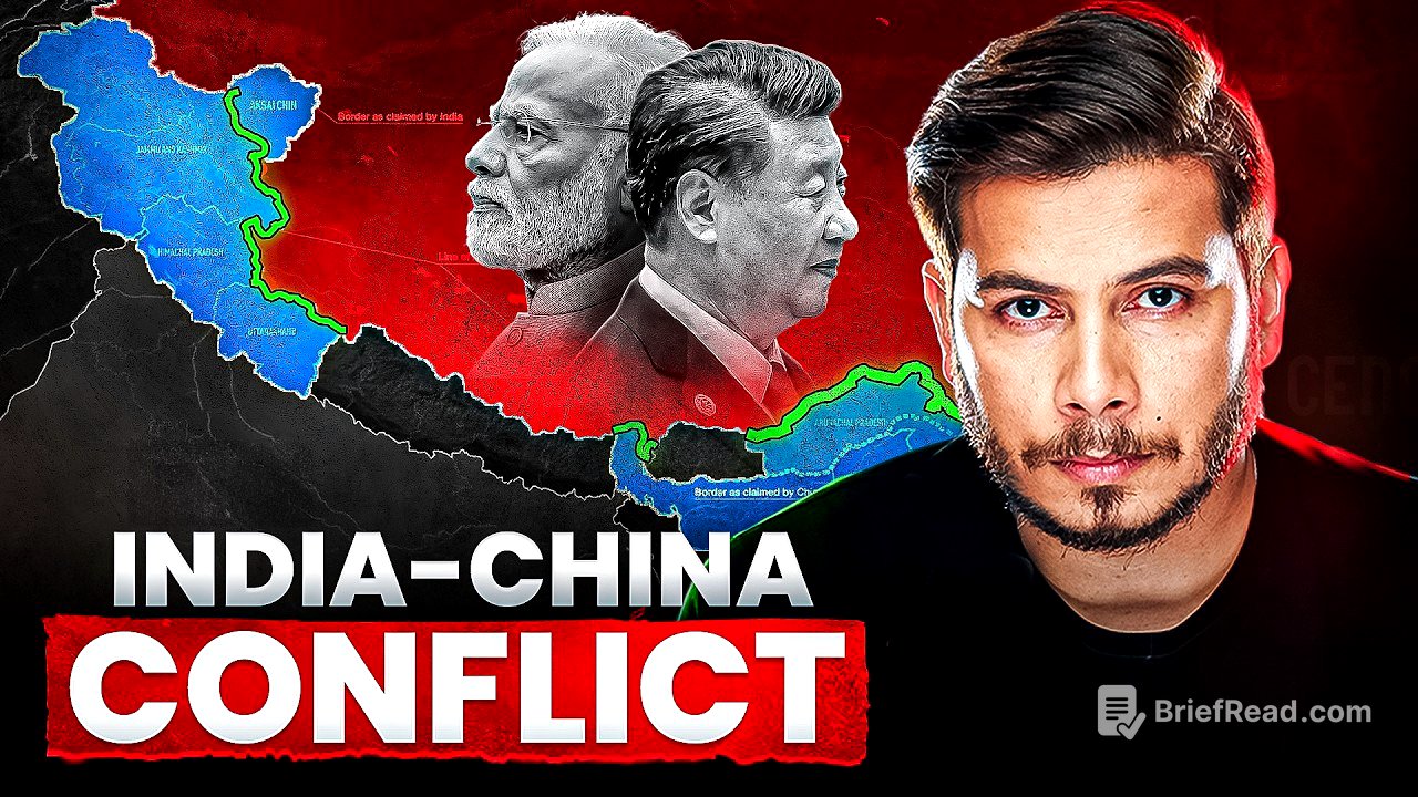
Alright, so this video by Nitish Rajput breaks down the whole India-China border situation, from way back in history to what's happening right now. He talks about treaties, wars, and how China has been slowly grabbing land. Key takeaways include:
- The border dispute is super old, going back to empires and treaties from centuries ago.
- China has been using sneaky tactics like "salami slicing" to gain territory over time.
- The current Line of Actual Control (LAC) is a complicated, undefined area with different versions claimed by India and China.
- Despite agreements, China has been building up infrastructure and creating villages near the LAC.
- The Galwan clash in 2020 was a big deal, and China has taken control of some Indian patrolling points.
Ancient Empires and the Treaty of Tingmosgang [1:13]
Back in 625 AD, there were different empires in India and a separate, huge Tibetan Empire that included parts of Ladakh and Arunachal Pradesh. By 842 AD, the Tibetan king Langdarma died, leading to infighting among his relatives. One of his great-grandsons, Nyimagon, didn't want to rule the whole empire, so he took the western part, which was pretty much ignored by everyone, and created the Ngari Kingdom. This is important because the disputed western area of the India-China border today was part of this Ngari Kingdom. Later, Nyimagon's son, Lhachen, expanded the kingdom even more and renamed it the Maryul Kingdom, which eventually became known as the Ladakh Kingdom around 1460. The Namgyal dynasty then took over, and the Ladakh empire started growing rapidly. The Tibetan Empire saw this as a threat and attacked Ladakh, leading to Ladakh seeking help from the Mughal Empire. This eventually led to the Treaty of Tingmosgang in 1684, which was the first time a border was decided on paper between Tibet and Ladakh to avoid future wars.
China's Qing Empire and the Treaty of Chusul [5:07]
In 1720, China's Qing Empire indirectly took control of Tibet by sending its military and replacing the Tibetan ruler. This meant that the Tibetan Empire was partially under China's control. Meanwhile, the Sikh Empire attacked and took control of the Dogra Empire (present-day Jammu & Kashmir) in 1819, which then led to the Dogra and Sikh empires attacking and taking control of Ladakh. So, the Tibetan Empire was split into two parts: Ladakh, which went under the Sikh-Dogra empire, and the rest of Tibet, which was indirectly ruled by China. In 1842, the Dogra and Sikh empires, wanting to control trade routes, started expanding Ladakh's area, which led to the Treaty of Chusul between Tibet and Dogra-Sikh, with China as a party. This treaty demarcated the border between Ladakh and Tibet, reaffirming the "old established frontiers" from the Treaty of Tingmosgang. Importantly, China officially accepted that Aksai Chin was part of Ladakh, strengthening India's claim on it today.
British Influence and Border Lines [9:08]
In 1845, with the British ruling India and fearing Russian expansion, they saw securing the northern boundary (Ladakh) as crucial. They attacked the Sikh Empire in 1845 and made them sign agreements favorable to the British. Gulab Singh then bought Kashmir from the British, but their main interest was Ladakh, to prevent Russian entry through Aksai Chin. Realizing the vulnerability of Aksai Chin, the British initiated the Great Trigonometrical Survey of India in 1855 to define a proper border, tasking W.H. Johnson with the survey. Johnson proposed the Johnson Line, which India still uses in its maps, placing strategic points within India. The British sent this map to Tibet and China, but China didn't agree. To secure other potential Russian entry points, the British made a convention with China in 1890, securing the Sikkim border. The India-China border was divided into three sectors: Aksai Chin (western), the Middle Sector, and Sikkim/Arunachal Pradesh (eastern). China disagreed with the Johnson Line in Aksai Chin.
Macartney-MacDonald Line and the Shimla Convention [12:41]
To avoid angering China and a potential alliance with Russia, the British proposed the Macartney-MacDonald Line in 1899, giving most of Aksai Chin to China while keeping strategic points. China didn't respond, and the line was sometimes used in British maps. In 1914, the British held the Shimla Convention with China and Tibet to create a buffer zone between British India and Chinese-controlled Tibet. They proposed dividing Tibet into Inner Tibet (for China) and Outer Tibet (under the Dalai Lama), with the MacMohan Line defining Arunachal Pradesh's border with Tibet. China refused to sign, claiming all of Tibet, but the British maintained that Tibet had the authority to decide its boundaries. Aksai Chin was shown under British India in official documents, and China didn't include it in its maps.
Post-Independence and China's Expansion [16:46]
After India's independence in 1947, Nehru accepted the British-made borders. In 1949, Mao Zedong's Communist party won the Chinese Civil War and established the People's Republic of China (PRC), invalidating previous agreements. In 1950, Mao attacked and took over Outer Tibet, with the Dalai Lama fleeing to India. India didn't help Tibet and even supplied rice to China. The question of who represented China in the UN arose, and Nehru reportedly declined a backdoor offer from the US for India to take the permanent security council seat, suggesting it be given to the PRC instead. China then started showing its true colors, making statements about Tibet being China's palm and other regions being its fingers. China began constructing Highway G219 in Aksai Chin without informing India.
The 1962 War and the Line of Actual Control (LAC) [20:36]
When India discovered the highway construction, it released an official map showing Aksai Chin as part of India and posted armies in the area. China responded by sending 16 land points defining its territory, which roughly corresponds to the current LAC. The 1962 war ensued, with China entering deep into Aksai Chin and Arunachal Pradesh. China planned to use Arunachal Pradesh for negotiation, trading it for Aksai Chin. The war stopped on November 21, 1962, with China retreating from Arunachal Pradesh but remaining in Aksai Chin, stopping around the 16 land points. The LAC is a complicated, undefined area with different land points claimed by India and China, creating a buffer zone where both countries patrol but don't have permanent military posts. India still claims the Johnson Line as the border.
Post-1962 Tensions and Peaceful Agreements [23:53]
In 1963, Pakistan gifted the Shaksgam Valley to China. In 1969, India started fencing the Sikkim border, leading China to do the same. This escalated into a clash in 1967, with Chinese soldiers attacking Indian soldiers at Nathu La pass. India retaliated, k*lling 340 Chinese soldiers. China wasn't very interested in Sikkim but created problems in the eastern border to pressure India, especially near the Siliguri Corridor (Chicken Neck). After several conflicts, India and China focused on peaceful agreements between 1993 and 1996. They recognized the LAC in the middle and eastern sectors but had differing perceptions in the western sector (Aksai Chin). They agreed not to use bombardment or weapons along the LAC, which is why conflicts often involve sticks and stones.
Salami Slicing and Infrastructure Development [28:45]
Despite the agreements, China began rapidly developing infrastructure near the LAC, which India saw as a threat. China then started using a "salami-slicing" strategy, posting its army in small areas, knowing that India wouldn't risk war over small gains. By 2007, China had conducted 130 secret incursions. India's infrastructure development was slow due to environmental concerns and Chinese aggression. China took advantage of this, and India lost presence in 26 patrolling points. The Aksai Chin area is complicated, with an undefined buffer zone and 65 marked patrolling points. China has fraudulently taken control of 26 of these patrolling points, restricting Indian access. China never allows the border to be fixed, benefiting from the undefined area for its salami-slicing strategy.
Recent Developments and the Galwan Clash [33:37]
China has started posting villages near the LAC, housing civilians for free to monitor Indian activities and deter potential attacks. India has also started constructing infrastructure, like the Daulat Beg Oldi road. In 2020, Chinese soldiers blocked Indian soldiers from patrolling past finger 4 on Pangong Tso Lake, violating agreements. This led to clashes in Galwan Valley, Hot Springs, and Depsang Plains. Despite commander-level talks, China didn't back off, leading to the Galwan clash on June 15, 2020, where 20 Indian soldiers were martyred and around 40 Chinese soldiers were k*lled. Satellite images showed China constructing posts in the area. Reports indicate that China has taken control of around 1000 sq km of Indian territory. India is now rapidly increasing its infrastructure near the LAC, surrounding China from all sides. China is also trying to surround India in the sea and supplying weapons to Pakistan. Experts believe a two-front war between India and China is likely in the future.